 English
 Spanish
 Russian
 Ukrainian
 Korean
 Chinese
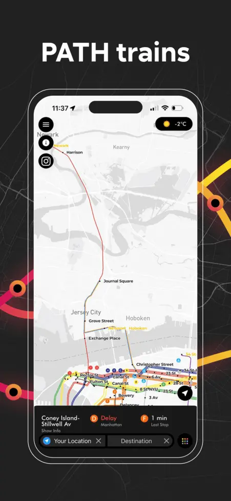
PATH Newark–World Trade Center
Newark–WTC train station list
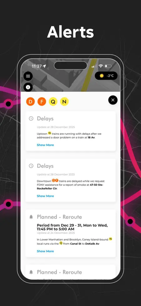
NW PATH Newark–World Trade Center Status & Alerts
No Alerts
PATH Newark–WTC FAQ
Route, Stops & Service PatternWhat is the route of the PATH Newark–WTC?
Is the PATH Newark–WTC line operating right now, and how many PATH Newark–WTC trains are running?
Is PATH Newark–WTC service running normally right now?
What are the operating hours for Newark–WTC?
How much does a PATH Newark–WTC train ride cost (TAPP, OMNY, Apple Pay, card)?
How do I pay for PATH?
Which PATH Newark–WTC stations have accessibility (ADA)?
These stations on this line are marked as fully ADA accessible in our static database (always verify elevators and gates on site):
For elevator status and accessible routing in AP Transit, use AP Transit on the map.
How often does the NW train come, and what is the maximum wait?
Which stations may have spacing issues for the next NW train (ETA on the arriving train)?
No stops on this line currently show a next-NW ETA score under 60 for the arriving train in our snapshot. This view updates automatically; if headways worsen, check Status & Alerts below or AP Transit.
Which PATH Newark–WTC stations currently have no service or a closed direction?
Below is one snapshot from the same feed as the No Service arrows on this page, but filtered to Newark–WTC only (other lines can still show times here). Stations are grouped by how Newark–WTC is missing in our feed—at most two panels.
All Lines


Download App
Real-time NYC subway, PATH, JFK AirTrain, route planning, station exits, transfer guidance, and service alerts in one map.

