 English
 Spanish
 Russian
 Ukrainian
 Korean
 Chinese
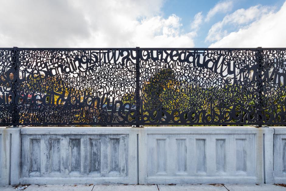
40?54’37.9”N 73?50’33.5”W
2021
Mount Vernon 10th Ave Bridge (New Haven Line)
Metro-North Railroad
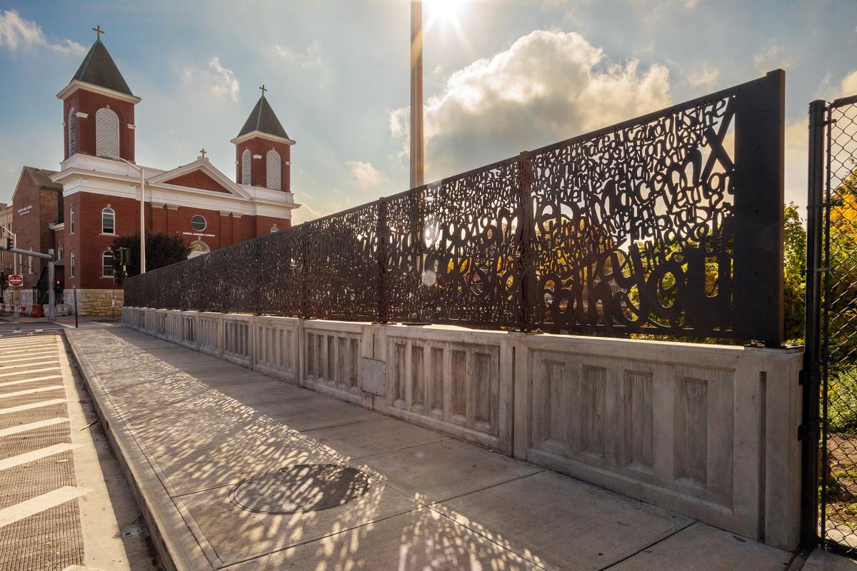
Spanning the full west side of the 10th Avenue bridge in Mount Vernon, artwork by Mark Fox incorporates stylized, decorative text that describes the site. The title, "40?54’37.9”N 73?50’33.5”W," provides the GPS coordinates for the exact center of the bridge.
Composed of 14 dynamic waterjet cut panels, fabricated by Milgo/Bufkin, and spanning approximately 550 square feet, the artwork features densely patterned words, undulating throughout the span of the bridge and evoking a train yard of crisscrossing tracks. The text is intended to be seen as an all-over pattern, and for viewers to spot singular words and phrases, or to see full sentences over time. To create the content for the text, Fox researched the history and factual information about Mount Vernon, reflected on his own experience in the city, and undertook in-depth conversation with local historians. While not necessary to the experience of the visual artwork, the text is a playful statement from the point of view of the bridge, its place in the world and time, and its relationship to the train that runs below.
The artist writes, "My idea for the 10th Avenue bridge in Mount Vernon was to create a work that is visually fluid and lively while engaging passersby in a game of discovery about the site of the bridge and its relationship to the city and surrounding area. The design, formed with handwritten cursive, is an original legend that includes details about Mount Vernon’s history and people as well as scientific fact about the viewer’s experience at the site. I want the legend to function as a kind of game so passersby can, quite literally, ‘read’ this bridge. For Mount Vernonites who cross frequently, my hope is that they will continue to enjoy new discoveries over time."


AP Transit
Download App
Real-time NYC subway, PATH, JFK AirTrain, route planning, station exits, transfer guidance, and service alerts in one map.

