 English
 Spanish
 Russian
 Ukrainian
 Korean
 Chinese
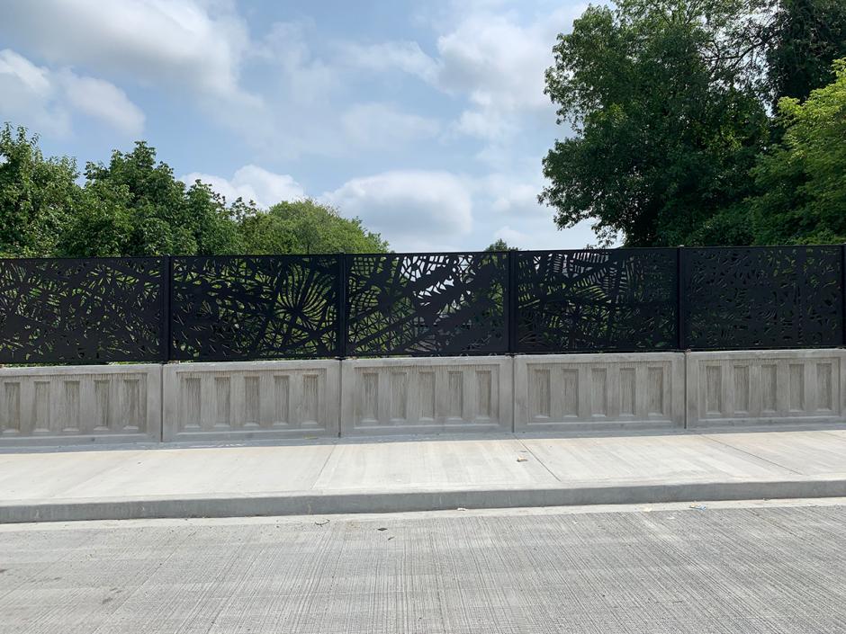
Line to Line
2019
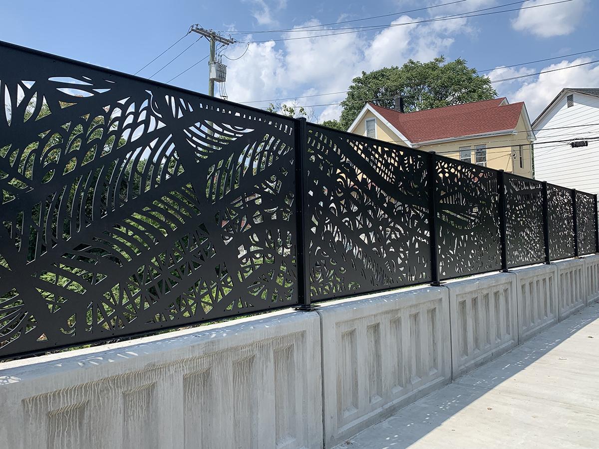
Mount Vernon 14 Ave Bridge (New Haven Line)
Metro-North Railroad
Inspired by the history of Mount Vernon (nicknamed “City of Homes”), Frances Gallardo researched the early blueprints of the city’s original planning design. The artwork, which replaces standard picket fencing on the 14th Avenue bridge parapets, is an invented map of Mount Vernon, based on the grid structure of city land plots and overlaid with personal mapping that imagines a person’s daily route through the city. The artist reflects on movement, exploration, and personal routes of the city’s residents and visitors, from different vantage points over time.
Gallardo hand cut print-outs of vintage maps to create intricate lacelike patterns, and then combined different pieces together in a patchwork. These designs were then made into digital files which were utilized by metal fabricator Milgo/Bufkin to cut aluminum panels with a waterjet and then painted black. The panels are integrated with the standard picket fencing on both sides of the new 14th Avenue bridge. The artwork connects elements of the city and the lines of the train tracks below the bridge, creating a rhythm of visual interest that will evolve over time as viewers create their own paths through the city and sparking imagination about the evolution of the community.
Gallardo hand cut print-outs of vintage maps to create intricate lacelike patterns, and then combined different pieces together in a patchwork. These designs were then made into digital files which were utilized by metal fabricator Milgo/Bufkin to cut aluminum panels with a waterjet and then painted black. The panels are integrated with the standard picket fencing on both sides of the new 14th Avenue bridge. The artwork connects elements of the city and the lines of the train tracks below the bridge, creating a rhythm of visual interest that will evolve over time as viewers create their own paths through the city and sparking imagination about the evolution of the community.


AP Transit
Download App
Real-time NYC subway, PATH, JFK AirTrain, route planning, station exits, transfer guidance, and service alerts in one map.

