 English
 Spanish
 Russian
 Ukrainian
 Korean
 Chinese
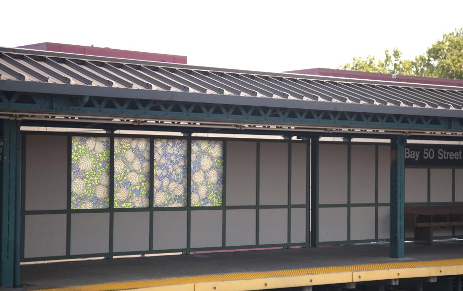
Internal Connectivity
2012
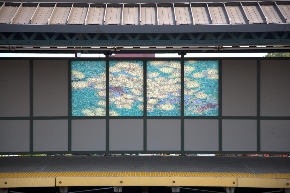
Bay 50th Street (D)
New York City Transit
Bay 50 St is adjacent to John Dewey High School and is one station away from Coney Island. This provides a natural setting for Daniel Zeller’s detailed and intricate abstract drawings, which address the connectivity of lives in an urban environment. Zeller studied satellite imagery, local streets, and biological systems along the D line and interpreted them into abstract patterns. Six drawings were recreated in luminous color on laminated glass panels installed along the platform windscreens.
As the artist’s response to the site, these colorful images have an organic quality that is in concert with the green space next to the station and the nearby bay area. In his drawings, Zeller introduces colors and curvilinear elements to the rigid structure of the elevated train line, as it sweeps through the Brooklyn terrain. Among the drawings, the satellite view of Brooklyn surrounding the Bay 50 St station may be most recognizable in some compositions. Others reflect varying degrees of abstraction that evolved from the satellite drawing and related images.
The work represents an artist keenly aware of his surroundings and who makes it his own, as he illuminates and highlights the ways in which infrastructure, nature, and human activity interact and evolve.


AP Transit
Download App
Real-time NYC subway, PATH, JFK AirTrain, route planning, station exits, transfer guidance, and service alerts in one map.

