 English
 Spanish
 Russian
 Ukrainian
 Korean
 Chinese
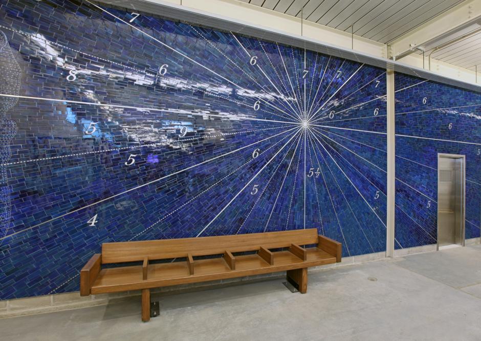
Nautical Charts – Gowanus & Red Hook from 1733-1922; Fathom Points + Compass Bearings
2013
Smith-9 Street (F,G)
New York City Transit
At the Smith-9 Sts Station, Alyson Shotz used the local maritime history of the surrounding Gowanus and Red Hook communities to create a series of windows and large wall mosaic artwork.
Shotz has a studio near the station, in Red Hook, and has long been fascinated by the history in the area’s cobblestone streets and old factory buildings. She brings the area’s maritime history to the forefront, first in the station’s mezzanine level, seen by arriving travelers who make their way from the elevated platform to escalators. On the journey to the platform, there are then 26 windows etched with silver reflective ink in layers of glass that create a prismatic effect as one passes by them. Each features a different historic nautical map of the waters that are in the general direction the viewer is facing. The maps are from the 1700’s to 1900’s, and show the Red Hook and Gowanus waterfronts and the changes evident as time progressed.
The contemporary landscape seen through the windows completes the evolution. The type of glass used makes the maps seem to fade in and out, depending on the time of day and the movement of transit riders through the space. Formerly boarded up, the station's rehabilitation enabled these windows to be reopened with new frames, making the station — the highest in the NYC Transit system — a place filled with natural light.
At the station's entrance on 9th Street, four large transom windows are etched with what appears to be an elegant line drawing, but is actually an historic plan of a boat hull, built in Brooklyn around 1770. The piece functions both as an abstract drawing and a marker for the ship building activity that once dominated the neighborhood. Mayer of Munich fabricated the windows based on Shotz's designs.
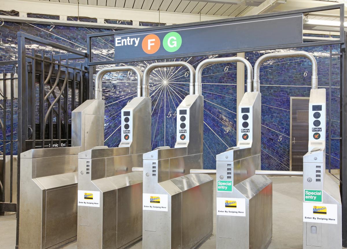
The rear wall of the station building may also seem like an abstract line drawing created in stainless steel against a vivid blue tile mosaic background. As one moves closer, however, it is revealed as a nautical map, with numbers for depth and letters for directions. The mosaic map was adapted from a 1779 nautical map of New York Harbor as seen from the shoreline of Brooklyn, and fabricated by Mosaika Art & Design. Shotz brings history to the present in the contemporary new station building.
Shotz has a studio near the station, in Red Hook, and has long been fascinated by the history in the area’s cobblestone streets and old factory buildings. She brings the area’s maritime history to the forefront, first in the station’s mezzanine level, seen by arriving travelers who make their way from the elevated platform to escalators. On the journey to the platform, there are then 26 windows etched with silver reflective ink in layers of glass that create a prismatic effect as one passes by them. Each features a different historic nautical map of the waters that are in the general direction the viewer is facing. The maps are from the 1700’s to 1900’s, and show the Red Hook and Gowanus waterfronts and the changes evident as time progressed.
The contemporary landscape seen through the windows completes the evolution. The type of glass used makes the maps seem to fade in and out, depending on the time of day and the movement of transit riders through the space. Formerly boarded up, the station's rehabilitation enabled these windows to be reopened with new frames, making the station — the highest in the NYC Transit system — a place filled with natural light.
At the station's entrance on 9th Street, four large transom windows are etched with what appears to be an elegant line drawing, but is actually an historic plan of a boat hull, built in Brooklyn around 1770. The piece functions both as an abstract drawing and a marker for the ship building activity that once dominated the neighborhood. Mayer of Munich fabricated the windows based on Shotz's designs.
The rear wall of the station building may also seem like an abstract line drawing created in stainless steel against a vivid blue tile mosaic background. As one moves closer, however, it is revealed as a nautical map, with numbers for depth and letters for directions. The mosaic map was adapted from a 1779 nautical map of New York Harbor as seen from the shoreline of Brooklyn, and fabricated by Mosaika Art & Design. Shotz brings history to the present in the contemporary new station building.


AP Transit
Download App
Real-time NYC subway, PATH, JFK AirTrain, route planning, station exits, transfer guidance, and service alerts in one map.

